


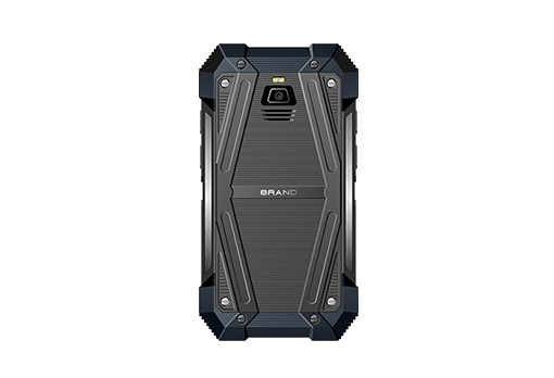


A handheld GPS tracking device is a portable device designed to track and record location data. These devices are crucial for activities such as hiking, surveying, and vehicle tracking. They provide real-time location information, helping users navigate and monitor movement. Handheld GPS tracking devices are valued for their accuracy, portability, and ease of use. By integrating GPS technology, they ensure reliable tracking and navigation, making them indispensable tools for both professional and recreational purposes. Whether used for exploring new trails or managing field surveys, these devices offer enhanced safety and efficiency.
Features of Handheld GPS Tracking Device
Handheld GPS tracking devices are essential tools for outdoor enthusiasts, professionals, and anyone needing precise location tracking. These devices come with a range of features designed to enhance their functionality and usability. Here, we explore twelve key features of handheld GPS tracking devices, focusing on how each contributes to their overall performance and user experience.
1. Screen Size and Display Quality
The screen size of a handheld GPS tracking device affects how easily users can read maps and data. Larger screens provide more detailed information and are easier to read in various lighting conditions. A high-resolution display enhances clarity, allowing users to view detailed maps and navigate with greater accuracy. For instance, devices with screens of 2.5 to 4.5 inches are common, with some offering touchscreen functionality for ease of use.
2. Battery Life
Battery life is a critical feature, especially for extended outdoor activities. Handheld GPS tracking devices with longer battery life can operate for hours or even days on a single charge. Typical battery life ranges from 10 to 30 hours, depending on usage and the device’s power-saving features. Devices with rechargeable lithium-ion batteries offer convenience and longevity.
3. Accuracy
Accuracy is paramount for any GPS device. Handheld GPS tracking devices generally offer accuracy within 5 to 10 meters. Advanced models may provide even higher precision through features like Differential GPS (DGPS) or augmentation systems. Accuracy is crucial for tasks like navigation, geocaching, and surveying.
4. Durability and Weather Resistance
Handheld GPS tracking devices are often used in rugged environments, so durability and weather resistance are essential. Devices are designed to withstand harsh conditions, including rain, dust, and impacts. Look for devices with an IPX7 rating or higher, indicating they are waterproof and dustproof.
5. Ease of Use
User-friendly interfaces enhance the experience of handheld GPS devices. Features such as intuitive menus, easy-to-read maps, and quick access buttons contribute to a more seamless user experience. Touchscreen interfaces and customizable settings can further improve usability.
6. Preloaded Maps and Data
Preloaded maps and data are valuable for immediate use without needing to download additional information. Handheld GPS tracking devices may come with topographic maps, street maps, and points of interest. Some models allow users to update or download additional maps as needed.
7. Waypoints and Route Planning
The ability to set waypoints and plan routes is crucial for effective navigation. Handheld GPS devices typically offer features for marking locations, creating routes, and tracking progress. This functionality is particularly useful for hikers, geocachers, and adventurers.
8. GPS and GLONASS Compatibility
Many handheld GPS tracking devices support both GPS and GLONASS satellite systems, enhancing signal reception and accuracy. This dual-system support ensures better performance in challenging environments, such as dense forests or urban areas with tall buildings.
9. Altimeter and Barometer
Integrated altimeters and barometers provide additional information about elevation and weather conditions. These sensors are valuable for hiking and mountaineering, helping users monitor altitude changes and weather trends.
10. Connectivity Options
Connectivity features, such as Bluetooth and USB ports, allow for data transfer and synchronization with other devices. Some handheld GPS devices offer wireless connectivity for sharing location data or accessing additional resources online.
11. Geocaching Features
For geocachers, specific features such as geocaching modes, electronic compasses, and the ability to upload and download geocache information are essential. These features facilitate finding hidden caches and recording successful finds.
12. Customizable Settings and Alerts
Customizable settings and alerts enhance the functionality of handheld GPS tracking devices. Users can set preferences for navigation alerts, battery warnings, and user-defined data displays. This personalization ensures the device meets individual needs and preferences.
How to Locate Reliable GPS Jammer Teardown Services Nearby
Applications of Handheld GPS Tracking Device
Handheld GPS tracking devices offer a wide range of applications across various fields. Here, we explore twelve key applications, explaining how these devices are used in each context and the benefits they provide.
1. Hiking and Outdoor Adventures
Handheld GPS tracking devices are invaluable for hikers and outdoor enthusiasts. They provide accurate navigation, help track routes, and mark waypoints. These devices enhance safety by ensuring hikers can find their way back to their starting point or navigate through unfamiliar terrain.
2. Geocaching
Geocaching is a popular recreational activity where participants use GPS devices to find hidden caches. Handheld GPS tracking devices with geocaching features allow users to upload and download cache locations, enhancing the geocaching experience with precise navigation and logging capabilities.
3. Surveying
In surveying, handheld GPS tracking devices are used to collect precise geographical data. They assist in mapping and measuring land, improving the accuracy of survey results. Features such as high precision, rugged design, and the ability to store and analyze data are crucial for effective surveying.
4. Vehicle Tracking
Handheld GPS tracking devices can be used for tracking vehicles, especially in fleet management or for personal use. They help monitor vehicle locations, track routes, and ensure timely arrivals. This application is useful for logistics companies and individuals who want to keep tabs on their vehicles.
5. Emergency Response
In emergency situations, handheld GPS tracking devices provide crucial location data for first responders. They help in locating individuals in distress, coordinating rescue operations, and navigating through challenging environments. Their accuracy and reliability are vital for effective emergency response.
6. Fishing and Boating
For anglers and boaters, handheld GPS tracking devices assist in finding fishing spots, navigating waterways, and marking waypoints. They provide essential navigation tools and help in planning routes and tracking movements on water.
7. Camping
Campers use handheld GPS tracking devices to navigate to campsites, mark locations, and explore surrounding areas. These devices help in planning camping trips, ensuring safety, and avoiding getting lost in unfamiliar locations.
8. Hunting
Hunters benefit from handheld GPS tracking devices for tracking game, marking hunting spots, and navigating through dense forests. They provide accurate location data and enhance safety by helping hunters return to their starting point or find their way through challenging terrain.
9. Search and Rescue Operations
In search and rescue operations, handheld GPS tracking devices play a crucial role in locating missing persons and coordinating search efforts. Their ability to provide precise location data and function in adverse conditions is essential for successful rescue missions.
10. Scientific Research
Researchers use handheld GPS tracking devices to collect geographical data for scientific studies. They assist in mapping study areas, tracking movements, and gathering data for environmental and ecological research.
11. Event Planning
For large outdoor events, handheld GPS tracking devices help in coordinating logistics, managing event layouts, and ensuring smooth operations. They provide precise location information and assist in navigating large or complex event areas.
12. Travel and Tourism
Travelers use handheld GPS tracking device to explore new destinations, navigate unfamiliar areas, and find points of interest. These devices enhance travel experiences by providing reliable navigation and detailed maps of tourist attractions.
Ethical Considerations from the GPS Jammer Forum Community
Handheld GPS Tracking Device for Surveying
Handheld GPS tracking devices are essential tools in surveying, offering precision and durability required for accurate geographical data collection. Here, we delve into the specific features needed for effective surveying and provide examples of how these devices improve efficiency and accuracy in surveying tasks.
Features Needed for Surveying
- High Precision
Surveying demands high precision to ensure the accuracy of measurements and data. Handheld GPS tracking devices designed for surveying often offer precision within a few centimeters. This level of accuracy is crucial for creating detailed maps and conducting reliable analysis. Devices equipped with Differential GPS (DGPS) or Real-Time Kinematic (RTK) capabilities provide enhanced precision, essential for professional surveying tasks.
- Rugged Design
Surveying often occurs in challenging environments, such as construction sites or remote outdoor areas. Therefore, handheld GPS tracking devices used in surveying need to be rugged and durable. Features like shock resistance, waterproofing, and dustproofing ensure that these devices can withstand harsh conditions and continue to operate reliably. An IPX7 rating or higher indicates that a device is waterproof and suitable for use in various weather conditions.
- Data Storage and Management
Surveying involves the collection and management of extensive data. Handheld GPS tracking devices with substantial data storage capacity allow surveyors to store large amounts of geographical information. Additionally, these devices often come with data management features, such as the ability to categorize and organize data, making it easier to analyze and process information efficiently.
- High-Resolution Display
A high-resolution display is crucial for viewing detailed maps and survey data accurately. Handheld GPS tracking devices with clear and vibrant screens enable surveyors to read and interpret data effectively, reducing the risk of errors and improving overall efficiency. Displays that offer good visibility in various lighting conditions, such as bright sunlight, are particularly valuable.
- Integration with Surveying Software
Integration with specialized surveying software enhances the functionality of handheld GPS tracking devices. Devices that can sync with software tools allow surveyors to import and export data seamlessly. This integration facilitates advanced data analysis, creating detailed survey reports, and producing accurate maps, contributing to more efficient and precise surveying processes.
- Battery Life
Extended battery life is essential for surveyors who work long hours or in remote locations. Handheld GPS tracking devices with long-lasting batteries ensure that surveyors can complete their tasks without interruptions. Devices offering 20 to 30 hours of battery life are common and provide the reliability needed for extended fieldwork.
- Multiple Coordinate Systems
Surveying often requires the use of various coordinate systems. Handheld GPS tracking devices that support multiple coordinate systems, such as UTM (Universal Transverse Mercator) and latitude/longitude, offer greater flexibility. This capability allows surveyors to work with different geographic data formats and coordinate systems as needed for specific projects.
- Ease of Use and Customization
Ease of use and customization options contribute to the efficiency of handheld GPS tracking devices in surveying. Features like user-friendly interfaces, customizable settings, and intuitive controls make it easier for surveyors to operate the device and tailor it to their specific needs. Customizable data fields and map views allow surveyors to focus on the information most relevant to their tasks.
Examples of Improved Surveying Efficiency
- Enhanced Accuracy in Land Mapping
Handheld GPS tracking devices with high precision and integration with surveying software enable surveyors to produce accurate land maps. The precise data collected ensures that maps are detailed and reliable, aiding in property development and planning.
- Efficient Data Collection
Devices with substantial data storage and management features streamline the data collection process. Surveyors can gather and organize data efficiently, reducing the time spent on data entry and analysis.
- Improved Field Productivity
Rugged and durable devices withstand harsh field conditions, allowing surveyors to work effectively in challenging environments. The reliability of these devices enhances productivity and reduces the likelihood of equipment failure.
- Accurate Terrain Analysis
High-resolution displays and multiple coordinate system support facilitate accurate terrain analysis. Surveyors can view detailed topographic maps and analyze elevation changes, contributing to more precise environmental assessments.
- Seamless Data Integration
Integration with surveying software allows for seamless data transfer and analysis. Surveyors can easily import field data into software tools, creating detailed reports and maps with minimal effort.
- Reliable Performance in Remote Areas
Extended battery life ensures that handheld GPS tracking device remain operational in remote areas where recharging may not be feasible. This reliability is crucial for completing surveying tasks in locations with limited access to power sources.
How GPS Jammer Car Theft Can Be Prevented with Technology
Handheld GPS Tracking Device for Hiking
Hiking Use: Handheld GPS tracking devices have become indispensable tools for hikers, providing critical navigation support and safety features in challenging terrains. These devices are designed to ensure that hikers remain on the right path, even in remote areas where traditional maps may be inadequate. A good handheld GPS tracking device for hiking should possess several key features to enhance the hiking experience and safety.
Key Features for Hiking:
- Long Battery Life: A critical feature for hiking is the device’s battery life. Long-lasting batteries ensure that the GPS tracker remains operational for extended periods, which is crucial for long hikes or multi-day trips. Devices with extended battery life reduce the need for frequent recharging and can be a lifesaver in emergencies.
- Weather Resistance: Hiking often exposes devices to various weather conditions, including rain, dust, and extreme temperatures. Therefore, a weather-resistant or waterproof handheld GPS tracking device is essential to ensure reliability and durability in all conditions.
- Ease of Use: A user-friendly interface with a clear display and simple navigation is crucial for quick and accurate use during hikes. Devices that are easy to operate allow hikers to focus on their surroundings rather than struggling with complex menus.
- Durability: Hiking GPS devices should be rugged and durable to withstand the physical demands of outdoor activities. Shock-resistant designs help prevent damage from accidental drops or rough handling.
- Mapping and Navigation Features: Advanced mapping capabilities, including preloaded topographic maps and the ability to create and follow waypoints, are valuable for hikers. These features help hikers navigate unfamiliar terrain and plan their routes effectively.
- Geocaching Capabilities: Some handheld GPS devices come with built-in geocaching features, allowing hikers to participate in this outdoor treasure-hunting game. This feature can add an extra layer of fun and engagement to the hiking experience.
- SOS Functionality: Safety is paramount during hikes. GPS trackers with SOS functionality enable hikers to send distress signals in emergencies, alerting rescuers to their location quickly.
- Altimeter and Barometer: Devices with altimeter and barometer functions provide additional data on elevation and weather changes, helping hikers monitor their progress and prepare for changes in weather conditions.
Choosing the Best Device for Hiking:
- Evaluate Battery Life: Choose a device with a battery life that suits the duration of your hikes. Consider devices with rechargeable batteries that offer extended use on a single charge.
- Check for Weather Resistance: Ensure that the device is rated for water and dust resistance to handle various weather conditions.
- Consider the User Interface: Select a device with an intuitive and easy-to-read display, especially for use in bright sunlight or low-light conditions.
- Look for Durability: Opt for devices designed to withstand impacts, drops, and rough handling.
- Assess Mapping Features: Verify that the device includes detailed maps and supports waypoint navigation.
- Evaluate Additional Features: Determine if additional features like geocaching or SOS functionality are important for your hiking needs.
- Compare Size and Weight: Choose a device that is lightweight and compact enough to carry comfortably on hikes.
- Read Reviews and Ratings: Look for reviews from other hikers to gauge the performance and reliability of the device in real-world conditions.
Handheld GPS Tracking Device for Vehicle Tracking
Vehicle Tracking Use: Handheld GPS tracking device can be effectively utilized for tracking vehicles, offering a range of features to monitor vehicle locations, routes, and other critical data. These devices are valuable for personal use, fleet management, and security purposes.
Key Features for Vehicle Tracking:
- Real-Time Tracking: A crucial feature for vehicle tracking is real-time tracking capability. This allows users to monitor the exact location of their vehicle at any given time, providing valuable information for security and logistical purposes.
- Battery Longevity: While vehicle tracking often involves stationary or semi-stationary use, devices with long battery life still ensure that the tracker remains functional over extended periods, especially for long trips or when used intermittently.
- Accuracy of Tracking: High accuracy in location tracking is essential for reliable vehicle monitoring. Devices with precise GPS technology provide accurate data on vehicle position, speed, and movement.
- Geofencing Capabilities: Geofencing allows users to set virtual boundaries on a map. The device can alert the user if the vehicle enters or exits these predefined areas, which is useful for security and fleet management.
- Historical Data and Reporting: The ability to access historical tracking data and generate reports helps users analyze vehicle usage patterns, optimize routes, and improve overall management.
- SOS and Emergency Alerts: Devices with SOS functionality can send emergency alerts if the vehicle is involved in an accident or if unauthorized movement is detected.
- Integration with Other Systems: Compatibility with other vehicle systems or tracking platforms enhances the versatility of the GPS tracker, allowing for integration with security systems or fleet management software.
- Ease of Installation: Handheld GPS tracking devices should be easy to install in vehicles, whether through mounting options or direct integration with the vehicle’s electrical system.
Guidance on Integration with Vehicles:
- Determine Installation Method: Choose a device that can be easily installed in your vehicle, either through mounting brackets or connecting to the vehicle’s power supply.
- Verify Compatibility: Ensure that the device is compatible with your vehicle’s make and model, and check if additional adapters or accessories are needed.
- Check for Integration Features: Look for devices that offer integration with other vehicle management systems or security features.
- Consider Power Supply Options: If the device is battery-powered, ensure that it has sufficient battery life or consider options for connecting to the vehicle’s power source.
- Monitor Real-Time Tracking: Use the device’s real-time tracking capabilities to stay updated on the vehicle’s location and movement.
- Utilize Geofencing: Set up geofencing to receive alerts if the vehicle enters or exits specified areas.
- Analyze Historical Data: Review historical tracking data to assess vehicle usage and optimize routes.
- Review Alerts and Notifications: Configure SOS and emergency alerts to ensure you receive timely notifications in case of emergencies.
Best Practices for Using Handheld GPS Tracking Device
10 Usage Tips:
- Regular Maintenance: Keep the device clean and free from dust and moisture. Regularly check for software updates and ensure the Handheld GPS Tracking Device is functioning correctly.
- Battery Management: Monitor battery levels and recharge or replace batteries as needed to ensure the device remains operational during use.
- Proper Storage: Store the device in a protective case or pouch when not in use to prevent physical damage and exposure to environmental elements.
- Calibration: Calibrate the device periodically to maintain accurate tracking and navigation. Follow the manufacturer’s instructions for calibration procedures.
- Use of Accessories: Utilize any additional accessories or mounts designed for the device to enhance its usability and functionality in different scenarios.
- Understand Features: Familiarize yourself with the device’s features and functions to maximize its effectiveness in various applications, such as hiking, vehicle tracking, or surveying.
- Secure Data: Ensure that any data collected by the device is stored securely and handled with privacy in mind, especially when used for tracking personal or sensitive information.
- Follow Guidelines: Adhere to any guidelines or regulations related to the use of GPS tracking devices in your area to ensure compliance and avoid legal issues.
- Regular Updates: Update the device’s software and maps as needed to keep the tracking data accurate and current.
- Emergency Preparedness: Keep the device readily accessible in emergency situations and ensure that it is fully charged or connected to a power source for reliable performance.
FAQs about Handheld GPS Tracking Device
A handheld GPS device can be a valuable tool for outdoor enthusiasts, hikers, and those who frequently navigate unfamiliar terrain. Unlike smartphones, handheld GPS units are specifically designed for navigation and can offer superior accuracy and reliability in remote areas where cellular service may be unavailable. They are built to withstand harsh environmental conditions, such as rain and dust, which can be a significant advantage in rugged outdoor settings. Additionally, handheld GPS devices often feature long battery life compared to smartphones, making them ideal for extended trips. They also come with preloaded maps and detailed topographic information that can be crucial for navigation. For individuals who engage in activities like hiking, geocaching, or off-roading, investing in a handheld GPS can enhance safety and provide more precise navigation tools than smartphone apps alone.
Handheld GPS devices generally work in most outdoor environments, thanks to their reliance on satellite signals. They can provide accurate location data in a wide range of locations, from dense forests to open fields. However, their performance can be affected by certain conditions. For instance, heavy tree cover, deep canyons, or tall buildings can obstruct satellite signals and reduce accuracy. While handheld GPS devices are designed to function in challenging environments better than most smartphones, they may still encounter difficulties in areas with poor satellite visibility. It’s important to note that in completely enclosed spaces, such as indoors or underground, GPS signals may not be accessible, thus limiting the device’s functionality. For optimal performance, ensure that the handheld GPS device is used in areas with a clear view of the sky.
A handheld GPS, or Global Positioning System device, is a portable electronic device used for navigation and location tracking. Unlike car GPS units, which are designed for in-vehicle use, handheld GPS devices are compact and rugged, making them suitable for outdoor activities such as hiking, geocaching, and hunting. These devices use satellite signals to determine and display the user’s precise location on a map. Handheld GPS units typically come with features like built-in maps, waypoint marking, and route planning, which aid users in navigation. They are equipped with durable, weather-resistant casings to withstand harsh environmental conditions. Additionally, many handheld GPS devices offer long battery life and are designed to function effectively even in remote locations where cellular coverage is sparse or nonexistent.
Handheld GPS devices generally offer high accuracy, with most units providing location data within 5 to 10 meters of the actual position. This level of accuracy is suitable for most outdoor navigation needs, such as hiking, geocaching, and off-road driving. The accuracy of a handheld GPS can be influenced by several factors, including the quality of the device, the number of satellites in view, and environmental conditions. For instance, dense foliage, tall buildings, or mountainous terrain can obstruct satellite signals and reduce accuracy. Advanced handheld GPS devices may include additional features such as differential GPS (DGPS) or augmented satellite systems to enhance accuracy further. It’s important to regularly update the device’s firmware and maps to ensure the best performance and accuracy during use.
